
Integrated Flood and Drought Risk Management
In light of climate change and land use changes, an increase in flood and drought risks is expected. As a result, integrated flood and drought risk management is becoming increasingly important.
Floods
Integrated Flood Risk Management
Integrated flood risk management aims to reduce risks proactively, for example, through spatial planning measures, awareness-raising, or disaster response plans. The prioritization of such non-structural measures over technical flood protection measures has been anchored in Austria’s national legal frameworks and technical guidelines, based on the EU Floods Directive. There remains significant research and development potential in understanding flood processes, communicating and defining protection goals, and managing residual risks. Efforts must be intensified to preserve river corridors and create floodplains and retention areas. In the field of technical flood protection, the focus should be on completing planned public flood protection measures (closing gaps) and on monitoring and assessing the condition of existing protective structures.
Flood Risk Cycle
Following the extreme flood event of 2002, the EU Floods Directive was adopted and incorporated into national law. It became evident that absolute flood protection is unattainable, and instead, flood risk must be addressed. Flood risk encompasses both the hazard posed by “too much water” and the resulting damage. It is also necessary to consider disaster response, immediate measures during an event, restoration of livelihoods, flood prevention, and preparedness in an integrated manner.
At IWA, research is conducted on all these components, including model experiments on innovative protection measures and studies related to emergency response organizations.
Active and Passive Measures to Reduce Flood Risk
Active, structural measures to reduce flood risk are a research field at the Hydraulic Engineering Laboratory. These include flood protection dams, retention basins, linear measures, mobile flood protection systems, and the role of ecological river development.
Passive measures range from strategic improvements in spatial planning to studies on the role of vegetation and its management.
Extreme Events under Climate Change and Land Use Changes
Climate change and land use changes are leading to an increase in extreme events and associated damages. Research at BOKU addresses adaptation to these challenges, focusing on the design of structures and their interactions with anthropogenic uses.
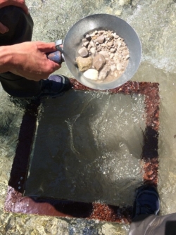
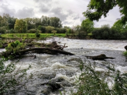
Role of Sediment Transport, Sediment Balance, and River Morphology
A major research focus at the Hydraulic Engineering Laboratory is the role of sediment transport, sediment balance, and river morphology. Many rivers in Austria and beyond have been heavily modified and often suffer from sediment deficits or surpluses. For example, riverbed incision increases the risk of structural instability, while sediment deposition can exacerbate flooding.
Large-scale experiments provide the basis for designing more resilient rivers, particularly with regard to slope, width, and sediment input.
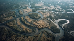
The loss of floodplains has been shown to exacerbate flood waves, particularly in terms of peak discharge, travel time, and water levels. To address this, the Floodplain Evaluation Matrix was developed at IWAH, providing an objective assessment of the importance of such areas and forming a basis for their protection and optimization.
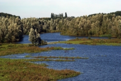
Conservation and Improvement of Floodplains
The loss of floodplains demonstrably leads to an intensification of the flood wave in terms of peak discharge, duration, and water level. At the IWA (Institute for Water Resources Management, Hydrology and Hydraulic Engineering), for instance, the Floodplain Evaluation Matrix was developed, which allows for an objective assessment of the importance of these areas and thus creates a basis for their evaluation and improvement.
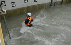
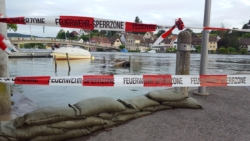
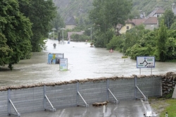
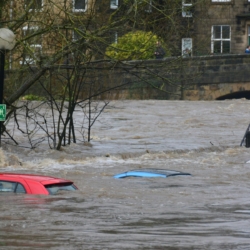
Drift Risk for Private Individuals and Emergency Responders
Unfortunately, flood events often result in fatalities, both among affected individuals and emergency responders. Experiments at the Hydraulic Engineering Laboratory investigate the drift risk for individuals, establishing thresholds for water depth and flow velocity that serve as a basis for hazard zone planning. Emergency response organizations can also conduct training to gain experience for real-life scenarios and receive specific recommendations to minimize operational risks.
Awareness Raising and Citizen Science
Projects in flood risk management include the development of measures to increase awareness of flood hazards. Innovations are also being made in the field of citizen science, enabling the collection of additional data for flood analysis.

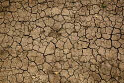
Drought
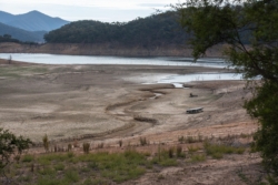
Impact of Climate Change on Low Flows in Rivers
The effects of climate change are increasingly evident in the form of low flows in rivers, posing challenges for navigation, hydropower, and ecology. BOKU research focuses on developing measures to improve low-flow conditions, such as enhancing river morphology or the interaction between surface water and groundwater.
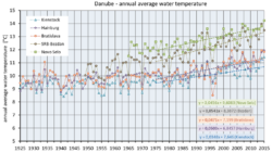
Changes in Water Temperature
Over the past 30 years, water temperatures in rivers like the Danube have risen by up to 2 degrees Celsius. This has implications for cooling water extraction and ecology, such as reduced oxygen levels. Research addresses not only the analysis of temperature changes but also the effects of shading through vegetation and the role of groundwater infiltration in rivers.
Role of Rivers and Floodplains in Minimizing Drought Risk
Rivers and floodplains play a crucial role in minimizing drought risk. For example, during high flows, floodplain inundation can recharge groundwater or retain water in the landscape. Research quantifies these processes and examines the positive effects of measures to improve river structure and floodplain management.
Importance of River Morphology for Low Flows
A variable and dynamic river morphology can lead to higher water depths during low-flow conditions, thereby supporting fish habitats and overall ecological health. It also increases the exchange surface between river water and groundwater. Analyses of these processes form the basis for developing future measures.
Development of Water Retention Measures for Drought
Research on water retention measures is gaining importance in light of advancing climate change and includes both structural and non-structural approaches. These studies lead to innovative solutions that often represent “win-win” scenarios. For example, measures can simultaneously reduce both flood and drought risks.